Hamilton Mountain Trail: Choose the Falls, Summit or Full Loop
You do not have to treat Hamilton Mountain as an all-or-nothing hike. Choose a turnaround before leaving Beacon Rock State Park, and save enough energy for the descent.
Research-based editorial guide · Official access status checked August 24, 2026 · No claim of a personal hike or firsthand test
OPEN SUBJECT TO BEACON ROCK STATE PARK STATUS — Confirm the park alert, current map, fire conditions and Discover Pass before departure.
Choose one of three objectives
|
Field |
Current planning note |
|
Managing area |
Beacon Rock State Park |
|
Shorter objective |
Rodney Falls / Pool of the Winds |
|
Full-loop estimate |
About 7.6 miles and 2,100 feet of gain; supplemental planning estimate |
|
Parking pass |
Discover Pass |
|
2026 pass prices |
$45 annual or $10 one-day, per Washington State Parks |
|
Key decision |
Choose a turnaround using the current map and the group’s remaining energy for the descent |
Pick a turnaround before leaving the parking lot
Hamilton Mountain can be three different outings: a waterfall hike, a summit climb or a full loop. Turning around at Rodney Falls or Pool of the Winds avoids most of the upper climb. Continuing to the summit adds sustained elevation gain, while completing the loop adds more distance and route-finding rather than simply extending the same out-and-back.
The commonly cited figures of about 7.6 miles and 2,100 feet of gain are supplemental planning estimates, not measurements published by Washington State Parks. Use the current official park map for junctions and closures, and use the estimates only to compare effort.
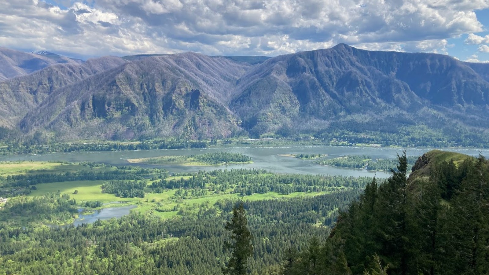
The summit objective adds exposure and a substantial descent. Photo: Mattsjc · CC BY-SA 4.0 · cropped and resized
First option: Rodney Falls and Pool of the Winds
Begin at the signed Hamilton Mountain trail system in Beacon Rock State Park. The lower forest trail reaches Rodney Falls and the side trip to Pool of the Winds. That spur can be wet and narrow, so it need not be part of every group’s plan. The falls are a sensible turnaround for limited time, uncertain weather or fading energy.
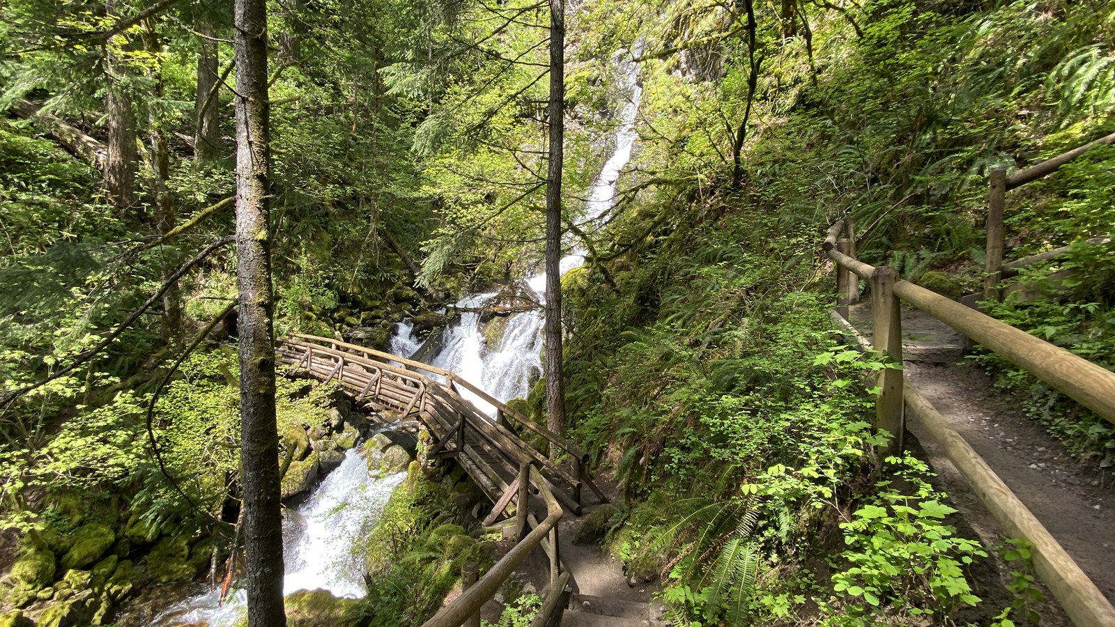
Rodney Falls can serve as the planned turnaround rather than a consolation stop. Photo: jhvanwa · CC0 1.0 · cropped and resized
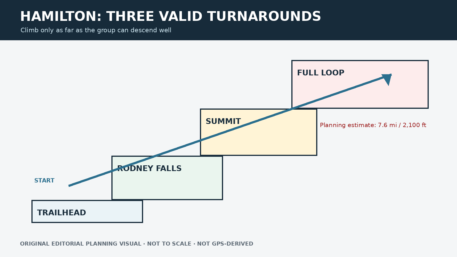
Original editorial planning graphic · not to scale · not GPS-derived
Second option: the summit
Above the falls, the trail settles into a sustained climb with broader views and greater exposure to weather. Reassess water, heat, wind and the group’s ability to descend before continuing. The summit is not the halfway point in terms of effort: the descent still demands controlled footing, and fatigue can lead to poor decisions on loose or steep trail.
Third option: the full loop
Choose the full loop only after confirming that it is open and that everyone can navigate its junctions. An out-and-back may be simpler when weather is deteriorating or the route is unfamiliar. A loop is not automatically more scenic or easier on the knees; its value depends on current conditions and the group’s route-finding confidence.
Discover Pass and vehicle access
Vehicle access at Beacon Rock State Park uses the Discover Pass system. Washington State Parks lists $45 for an annual pass and $10 for a one-day pass. Confirm where to buy and display the pass before arrival. A pass does not guarantee a parking space or make roadside parking legal.
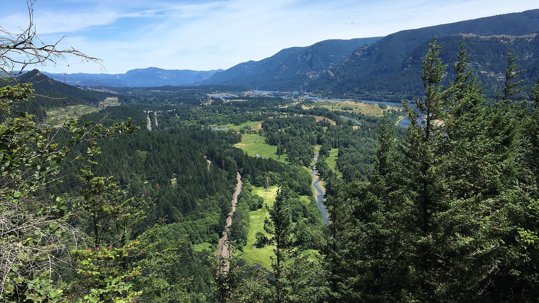
A clear-day view in Beacon Rock State Park adds regional context; Hamilton Mountain’s actual tread and conditions still require a current trail check. Photo: Kingofthedead · CC BY-SA 4.0 · cropped and resized
Alternatives for different goals
Rodney Falls is the built-in shorter option. For a route with a clear seasonal closure instead of several turnaround choices, compare Cape Horn. For a strenuous spring hike with its own permit system, compare Dog Mountain. These alternatives use different parking passes and closure rules, so check each one separately.
Use checkpoints instead of summit pressure
Set three timed checkpoints: the falls, the decision to continue above them and the point where the full loop no longer makes sense. At each one, consider water, temperature, wind, daylight and the pace of the least-experienced hiker, not just the strongest person. A slower-than-expected climb is a good reason to shorten the plan. On the descent, let faster hikers pass where the footing is stable and there is room to stay away from the edge.
Download the current Beacon Rock map rather than relying on a screenshot from an older blog. Mark the parking area and planned turnaround before cell service becomes unreliable. If the loop is closed or a junction is unclear, return by the route you know. Carry enough water for sustained climbing in hot weather, and expect slick roots and reduced visibility in wet or shoulder-season conditions. Current park alerts always override this planning guide.
Final pre-trip check
Related hiking guides
Sources and last checked
Official agency pages are the authority for closures, access, fees and rules. Supplemental organizations are used only for clearly labeled planning estimates. This guide is based on published sources and does not claim a firsthand hike. Recheck all time-sensitive details on the publication date and again before travel.
Last checked: August 24, 2026. Review the page whenever an alert, fire restriction, road or gate status, fee, permit, seasonal rule, trail repair or official map changes.
Photo and graphic credits
Columbia River Gorge from Hamilton Mountain.jpg — Mattsjc, CC BY-SA 4.0. · Hamilton Mountain in WA – 52174550875.jpg — jhvanwa, CC0. · Beacon Rock 07.jpg — Kingofthedead, CC BY-SA 4.0.
Functional visual: original editorial graphic created for this article; not a trail map, GPS track or measured elevation profile.