When Is the Best Time to Hike the Columbia River Gorge?
A practical guide to rain, snow, heat, wildfire smoke and changing trail conditions from the river corridor to Mount Hood.
Research-based planning guide · Official information checked August 28, 2026 · Recheck weather, roads and closures before travel
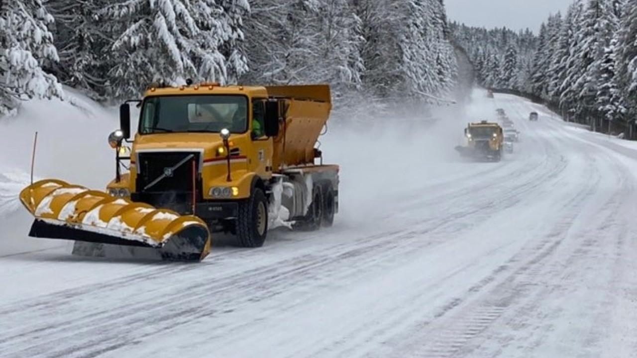
Snowplows work to reopen Interstate 84 after a winter storm in the Gorge. This historical photo does not show current road conditions. Photo: Oregon Department of Transportation · CC BY 2.0
The best season depends on the trail
The Columbia River Gorge can offer good hiking in every season, but not on every trail. A rainy winter day may suit a low waterfall walk while turning a shaded climb icy. Spring can bring wildflowers to the eastern Gorge while snow still covers routes closer to Mount Hood. A clear summer morning can become hot on an exposed ridge, and wildfire smoke can change a plan within hours.
A better question is, “Which part of the Gorge fits the conditions I will actually encounter?” To answer it, compare the usual seasonal pattern with the short-term forecast and the current status of the trail and access road.
Use this guide to understand seasonal patterns and decide when a lower, shadier or more sheltered route may be a better choice. It is not a live conditions report, so check current alerts, roads, air quality and fire restrictions again shortly before you leave.
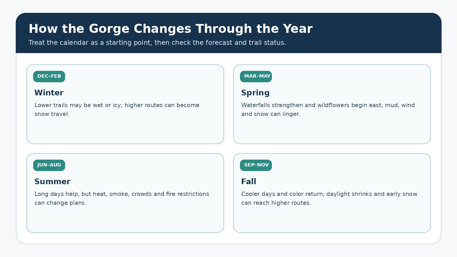
Conditions in the Gorge can change dramatically from one season to the next. Original editorial graphic; always check the latest forecast and trail status.
Why conditions vary so much across the Gorge
The Gorge runs through the Cascade Range, creating a sharp transition from the wetter western forest to the drier eastern slopes. Elevation adds another layer. River-level trailheads can be snow-free while a route climbing toward a ridge meets ice, and Mount Hood approaches can hold deep snow long after spring has reached Hood River or Rowena.
The western Gorge is known for mossy forest, waterfalls and frequent moisture. Those conditions can make winter hiking possible at low elevation, but wet rock, fallen branches and freeze-thaw ice deserve respect. The eastern Gorge dries sooner and can offer early wildflowers, yet its open slopes also bring strong sun, wind and little shade.
Routes south of the river corridor, including Mirror Lake, Tamanawas Falls and other Mount Hood trails, often have a longer snow season. Winter parking may fall under Oregon’s Sno-Park program, and a trail that is straightforward in summer may require snow-travel skills in winter.
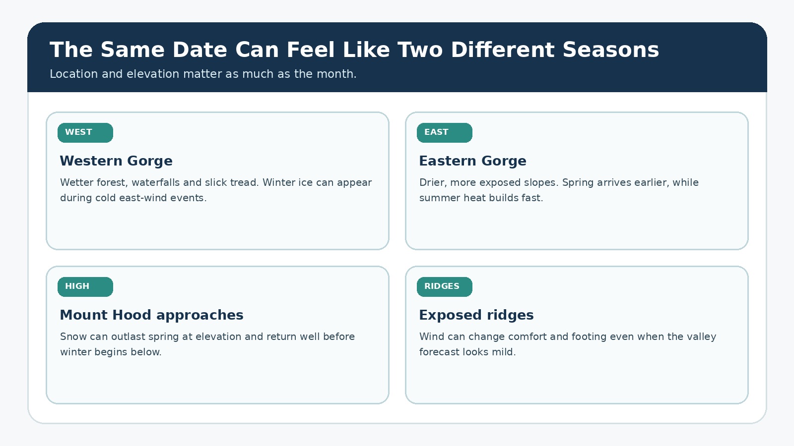
The month tells only part of the story; location and elevation often matter more. Original editorial graphic.
|
Zone |
What this area is often good for |
What can get in the way |
|
Western Gorge at lower elevation |
Waterfalls, shaded forest and many year-round trailheads. |
Heavy rain, slick rock, downed trees, ice during cold east-wind events and winter road incidents. |
|
Eastern Gorge |
Earlier spring wildflowers and drier shoulder-season hiking. |
Strong wind, exposed sun, ticks, rattlesnakes, fire restrictions and summer heat. |
|
Mount Hood approaches |
Cooler summer hiking and snowy winter outings. |
Snow-covered trails, winter navigation, traction, limited road access and Sno-Park permit requirements. |
|
Exposed ridges |
Wide views and spring or fall hiking when temperatures cooperate. |
Wind, lightning, rapid temperature shifts and little shelter. |
Winter hiking: rain below, snow at higher elevations
From December into February, low-elevation western Gorge trails often remain accessible between storms, but “open” does not mean dry. Expect wet tread, runoff, fallen branches and short daylight. Shaded switchbacks and waterfall spray zones can freeze even when the parking lot looks clear.
East-wind events can make the river corridor colder and icier than a Portland forecast suggests. Check the National Weather Service zone forecast for the part of the Gorge you will visit, then compare it with TripCheck for highway cameras, incidents and chain requirements. If the trailhead approach is icy, a later start does not necessarily solve the drive home.
At higher elevations, the outing may become snow travel rather than ordinary hiking. Footprints are not a substitute for navigation, and a summer trail sign can be buried. If the route requires packed-snow travel, traction devices or winter navigation, treat it as a winter outing and choose your companions, equipment and turnaround time accordingly.
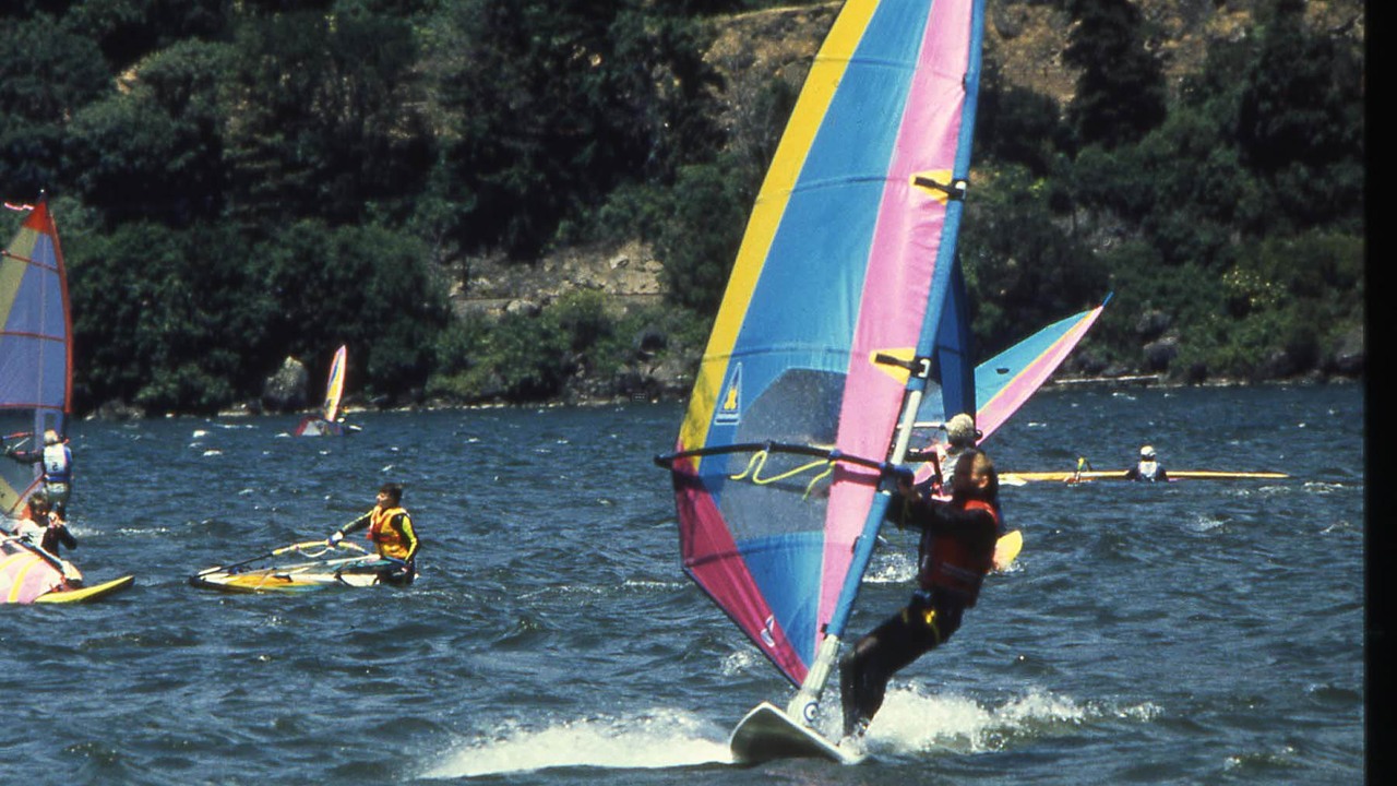
Strong winds are part of the Gorge’s character. On exposed ridges, they can affect balance, comfort and footing. Photo: Forest Service Pacific Northwest Region · Public domain
Spring waterfalls and eastern Gorge wildflowers
Spring is one of the Gorge’s most varied seasons. Waterfalls are often stronger after winter rain and snowmelt, while grass widows and later balsamroot begin appearing on open Washington and Oregon slopes. Bloom timing varies with temperature, elevation and the year’s weather, so a date on the calendar is never a guarantee.
The same moisture that feeds waterfalls can leave forest trails muddy and can trigger small slides or washouts. On eastern routes, stay on signed tread to protect thin soils and avoid trampling flowers. Seasonal wildlife closures and dog-leash requirements may overlap with peak bloom, particularly around Coyote Wall and Catherine Creek.
High routes can remain snowy through late spring. Before choosing Mirror Lake, Larch Mountain or a Mount Hood trail, check the current trail page and the access-road status rather than inferring conditions from a sunny forecast at river level.
Summer heat, smoke and fire restrictions
Summer brings long daylight and opens the greatest number of trails, but conditions still need close attention. Eastern Gorge slopes can become hot early, popular waterfalls fill quickly and exposed ridges offer little protection from sun. An early start helps only if the return also occurs before the hottest part of the day.
Check wildfire smoke separately from heat. AirNow’s Fire and Smoke Map shows nearby fire activity and monitoring data, but smoke can move quickly through the river corridor. Check air quality before leaving and again if visibility, odor or symptoms change. A clear photo or forecast from the previous evening may no longer reflect current conditions.
Fire restrictions regulate activities such as campfires and may differ across agencies. A fire restriction does not automatically mean a trail is closed, and a trail closure is not the same as a statewide fire-season declaration. Read the exact order, map, dates and land boundary on the managing agency’s site.
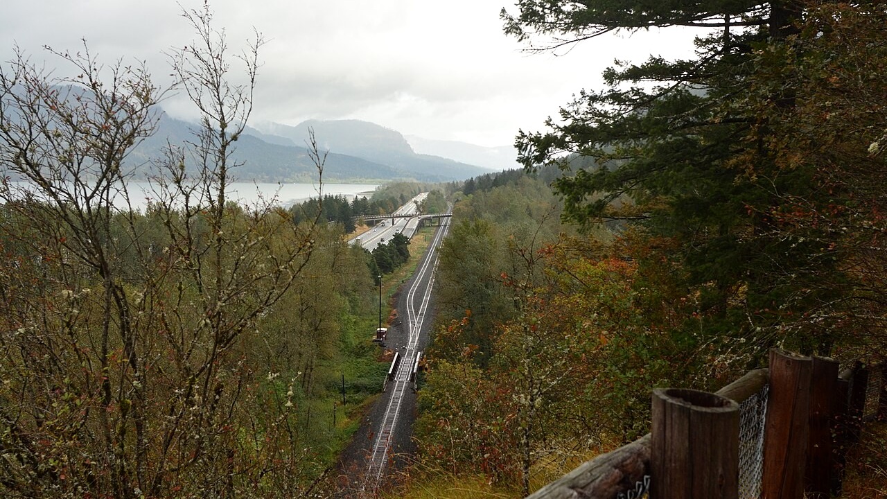
Autumn often brings cooler hiking weather to the western Gorge, but wet leaves, shorter days and early storms create their own challenges. Photo: Joe Mabel · CC BY-SA 4.0
Fall brings cooler days and earlier sunsets
September and October often bring cooler temperatures and fewer peak-summer visitors, especially after the first meaningful rain. Changing leaves brighten lower forest routes, and clear days can still provide expansive ridge views. The tradeoff is shorter daylight and a quicker shift from warm afternoon sun to a cold, wet evening.
Wet leaves can hide loose rock and make wooden steps slick. Early storms may drop branches or bring the first snow to Mount Hood while the river corridor remains mild. Set your turnaround time based on sunset and the slowest part of the route, not the pace you expect on the way out.
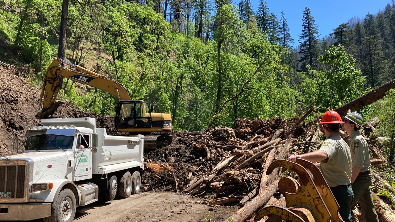
Crews clear landslide debris near Eagle Creek after storms in 2021. This historical photo shows why trail and road alerts can remain important after the weather improves. Photo: Forest Service Pacific Northwest Region · Public domain
Understanding trail alerts and closures
Official pages use words such as open, alert, restriction and closure for different purposes. “Open” means legal access is available; it does not promise a dry trail, a repaired bridge or a comfortable hike. An alert may describe a hazard without closing the route. A restriction limits a particular activity, location or time. A closure prohibits entry to the area named in the order.
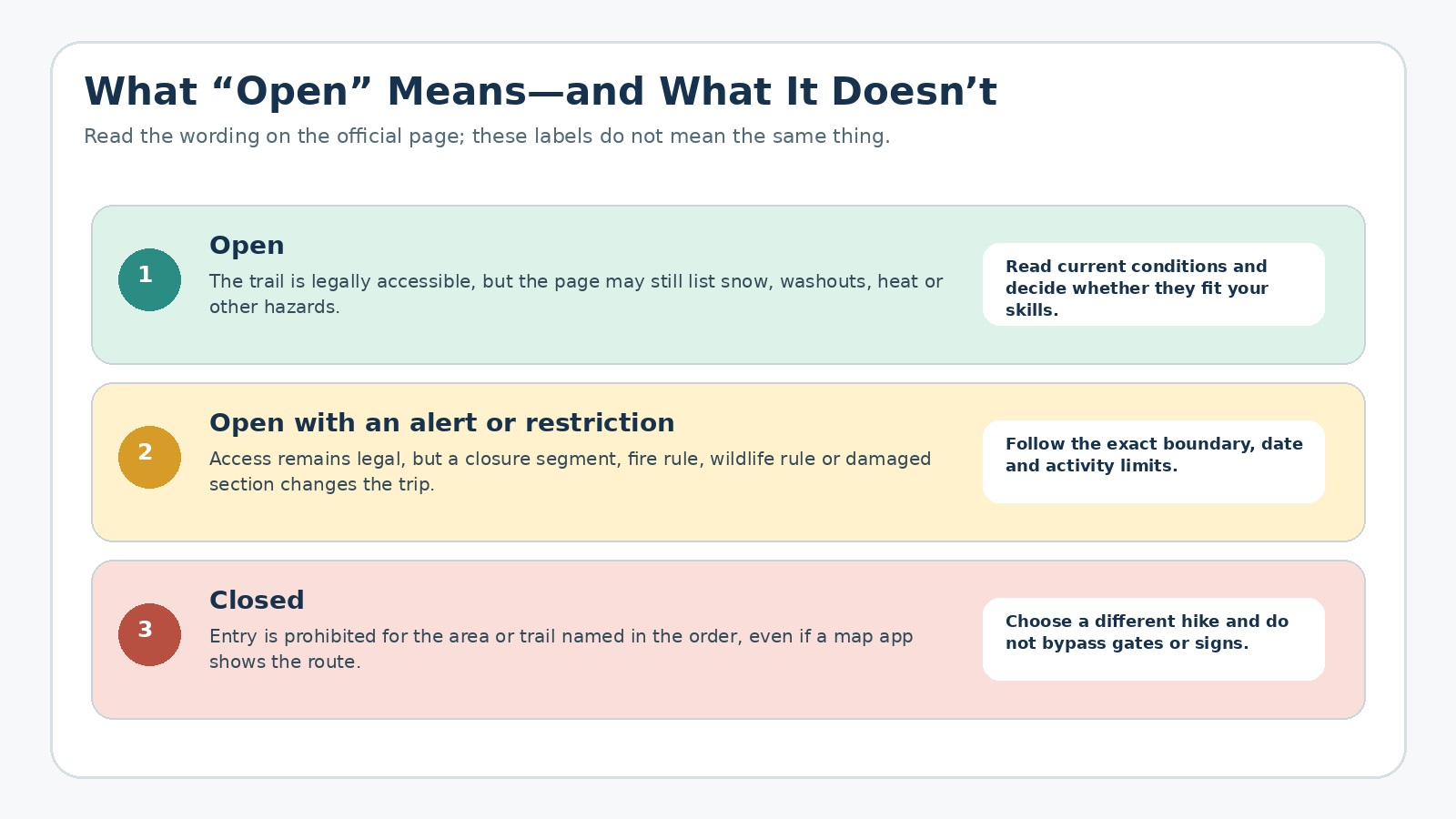
An open trail may still have alerts or restrictions. Original editorial graphic.
Read beyond the headline. Check the dates, the area covered and whether the notice applies to hikers, vehicles, fires, dogs or another activity. An old screenshot, social post or trail-app comment may remain visible after the official status changes.
Tamanawas Falls illustrates why the current page matters. After a washout and temporary closure, the Forest Service reported the trail open again in May 2026 with caution around slides and loose rock. An older search result or saved article may still say “closed,” while the word “open” on its own leaves out the remaining warning about slides and loose rock.
What to check in the 48 hours before your hike
|
When |
What to check |
Decision to make |
|
Two days before |
Managing-agency alert page, trail page and access-road status. |
Whether the route is open and the road and trailhead are accessible. |
|
The evening before |
Hourly NWS forecast, AirNow, TripCheck and fire restrictions. |
Start time, clothing, water, traction and whether the primary route still fits. |
|
Before leaving |
New alerts, road incidents, air quality and radar. |
Go, delay, switch to the backup or cancel. |
|
At the trailhead |
Posted signs, visible road or trail damage, wind, heat and smoke. |
Whether conditions on site match the plan you made at home. |
|
During the hike |
Time, pace, visibility, surface and changing weather. |
Turn around before daylight, weather or trail conditions make the return harder than planned. |
Choose a backup that avoids the same problem
A useful backup is not simply the same hike with a later start. Choose a route that avoids the problem affecting your first choice. If an eastern ridge is too hot or windy, move to a shorter shaded western trail. If waterfall spray and freezing temperatures make a shaded climb icy, consider a lower, more open walk. If smoke fills the corridor, changing from one Gorge trailhead to another may not improve the air.
Keep the backup modest. A shorter route with straightforward access is easier to assess when your first choice no longer works. Save its official page, parking details and driving directions before you lose reception. For parking permits and fees, use the dedicated Gorge parking guide; for transit alternatives, use the car-free hiking guide rather than duplicating those details here.
Where to hike in each season
|
Seasonal goal |
Places to consider |
Why they fit the goal |
When to choose another option |
|
Winter waterfall or forest walk |
Lower western Gorge state park trails |
Low elevation and short options can fit a wet-weather day. |
Ice, high wind, road incidents or active storm damage. |
|
Early spring wildflowers |
Catherine Creek, Coyote Wall or Rowena |
Open eastern slopes warm sooner and support distinctive blooms. |
Seasonal closures, strong wind, mud or peak congestion. |
|
Warm-weather shaded hike |
Wahclella Falls, Latourell Falls or Forest Park |
Forest cover can reduce direct sun compared with exposed ridges. |
Heat advisories, crowding, active maintenance or wildfire smoke. |
|
Summer high-elevation hike |
Mirror Lake or another Mount Hood route |
Higher terrain may be cooler after snow has melted. |
Lingering snow, thunderstorms, road work or fire restrictions. |
|
Fall viewpoint hike |
Angel’s Rest, Cape Horn or Rowena |
Cooler weather and clear air can improve exposed hiking. |
High wind, short daylight, wet leaves or early snow. |
Frequently asked questions
What is the best month to hike the Columbia River Gorge?
There is no universally best month. Late spring can be excellent for waterfalls and eastern Gorge wildflowers, summer opens more high-elevation trails, fall can bring cooler days, and winter may suit short low-elevation outings. The best choice depends on the specific route and current conditions.
Can you hike the Gorge in winter?
Yes, many lower trails are used year-round, but winter adds rain, ice, wind, storm debris and short daylight. Higher routes may require snow-travel skills and winter parking permits. Check the trail, road and weather sources for the exact destination.
When is wildflower season?
Blooming often begins on lower eastern Gorge slopes in early spring and continues later at higher elevations, but timing varies each year. Treat current bloom reports as a guide, not a guarantee, and stay on signed trails while following seasonal wildlife and dog restrictions.
How do I check wildfire smoke before a hike?
Use AirNow’s Fire and Smoke Map together with the local forecast and the managing agency’s alert page. Check again near departure because smoke can shift quickly. If air quality or visibility worsens, changing the route or postponing the trip may be the better decision.
Related hiking guides
Official sources checked for this guide
Rules and conditions can change. These official pages were checked on August 28, 2026; check them again before you leave.